Saturday, August 24, 2013

Deschutes River Trail Mountain Bike Ride from Sunriver to Bend

On August 23rd, a friend of mine, Jim, and I took a 24 mile ride on the Deschutes River Trail between Sunriver and Bend. We left Sunriver on paved bike paths for a few miles, then we hit the Benham Falls Trail. It was single track most of the way on the Deschutes River Trail, until we hit the town of Bend. Where we picked up a paved trail for a couple of miles. The single track along the Deschutes river was fun. Amazing views all along the way. The Lava Lands paralleled across most of the river. There were several meadows that had mini lakes that were created by spill over of the Deschutes.

The trail leading out of Sunriver. It rained the night before so the dust was much less of a problem.

Benham Falls on the Deschutes River


One of the meadows. It was heating up quick out of the shade. 

Trail through another meadow


I believe this is a ranch. But the view seemed forever. 

The trail along the Deschutes along one of the meadows. The one I believe is a ranch. 


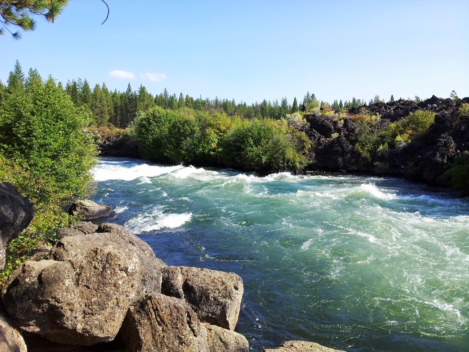
Some rapids along the Lava Flow. The lava flow is visible along much of the trail.  


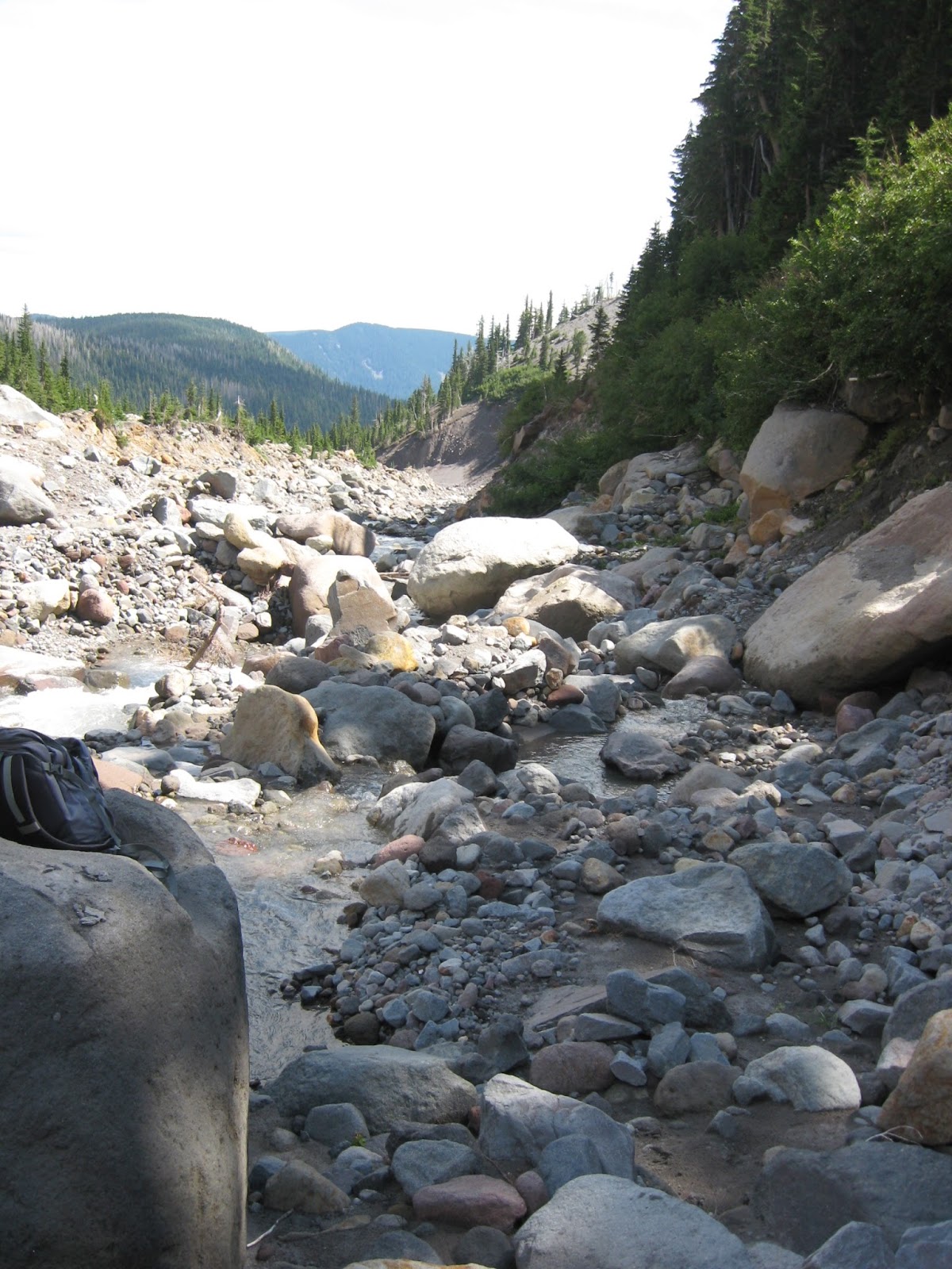
I have no idea what this is. There is a disconnected coax type cable dangling from it. I suspect it was for measuring water flow and transmitting it somewhere or something. 


The trail weaved in and out of the forest until we got closer to Bend. At some points along the river, there were some rocky spots that tested our abilities. I bit it a couple times, but i walked away unscathed. 

This map shows my GPS route. We ended up at St Francis McMenamins Pub in Bend. We were picked up and brought back to Sunriver by Jim's wife. 


Monday, August 19, 2013

Benham Falls Mountain Bike Ride

Spending the week in Sunriver. Took a Mountain bike ride to Benham Falls. This is down stream from Sunriver. From our condo at Tennis Village, round trip 15.5 miles. Half paved bike path. The other half is single track trail. Love the morning crisp air here. The views are breath taking. I could ride all day in this area.

Sunday, August 11, 2013

Elk Meadow to Lambertson Butte

Today I did something I have not done before. I joined a hiking group which I found on meetup.com. I signed up for a hike Lambertson Butte via Elk Meadows. The hike was on the north side of Mt Hood Meadows.

TOTAL MILES: 11+ miles 
ELEVATION GAIN: ~2200 ft (max 6633’) 
PACE: “Quick” (2.5 to 3.0 mph) 
DIFFICULTY RATING: Difficult/Very Difficult 
ESTIMATED HIKING TIME: ~7 hours 
The group has an organizer that attends the hike. The weather on Friday and Saturday was quite bad on the mountain. There were 12 people signed up for the hike on Sunday, but because of the previous days weather, all but 4 cancelled. So the four of us set out for this hike. It was amazing. I really enjoyed being with seasoned hikers that know their stuff. I learned quite a bit. I plan on joining other groups in the near future. This is a great way to hike.

The clouds were in and out most of the day, but by the time we reached the Butte, we were rewarded with Mt Hood making an appearance. We ate lunch on the Butte as well. This was amazing. Feet dangling over the edge of the cliff while eating.


 Above is the shot from where I was eating my lunch. 


Above, is where we had lunch up on the top of the butte. 


Above Stream crossing of Newton Creek. 


The flow of the river during the spring thaw is so powerful, it moves huge boulders and trees. 

Above is a view of Hood from Clark Creek.