A couple weeks ago, I attempted to find the backside trail to Badger Lake. I couldn't seem to find it. So I took another route today to the lake. I had seen Lookout Mountain on the topo map and started looking into the trails to and around it. There is a trail that that leads down from the top and connects to the lake. I could have reached the top of Lookout Mountain by hiking a similar route a couple weeks ago, but the first 2.5 miles were like climbing up the side of a building, so I decided to drive to a point closer. The 2 mile hike from the trail head was a little bit uphill, but not too bad. On the way to the top of Lookout Mountain, I encountered some very awesome views. I could have spent all day at the top. There was a 360 degree panoramic view. Unfortunately, it was a little hazy and some of the mountains were not very clear. I did make it down to the lake and my return trip I originally planned on taking a primitive road, instead of going back to Lookout Mountain. The views were so incredible, I decided to hike it all the way back up. The climb back up was difficult. I bonked at mile 8 and mile 10. I don't think I ate enough breakfast nor lunch. I added powdered Gatorade to my water bottle and that helped give me a boost. I carry the
SteriPEN when I hike. Helps make sure the water is safe. There were several creeks along the route and I was able to get some good refills. Badger Lake is pretty from a distance. What I don't understand is, all around it, is designated wilderness. There is a dirt road that leads to it and that road is not in the wilderness. Thus, the lake attracts some interesting folks. I hiked a little around the lake and even though the perimeter of lake is wilderness, people treat it with disrespect. There was garbage spread around each campsite. I was disappointed. I doubt I will trek to that lake again, but there are some nice trails in the area I may explore. Below are pics from my hike.
In the Parking Lot, a comfy, well, not so comfy latrine. Almost thought it was a cabin :)
The trek from the parking lot took me through many meadows. I expected to see a deer or two, but nothing. Could be that it is bow season and I did walk up on a couple of hunters walking along the trail. So increased activity in the area.
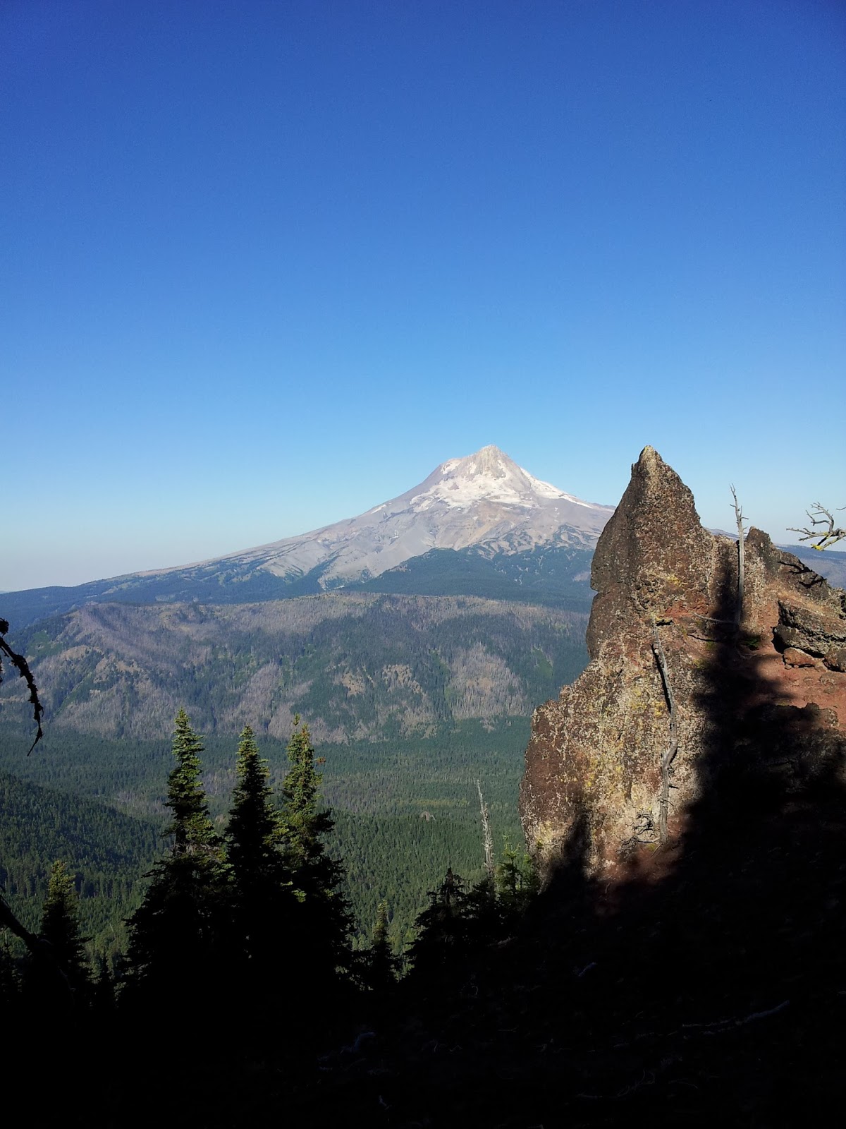
First view of WyEast (Mt Hood)
Some Awesome rock formations along the trail to the summit of Lookout Mountain.
It was hard to keep a steady pace with views like this around every turn.
Faintly in the distance, is Mt Jefferson. (Center left)
These rocks looked man made, but they are natural. Very cool formation.
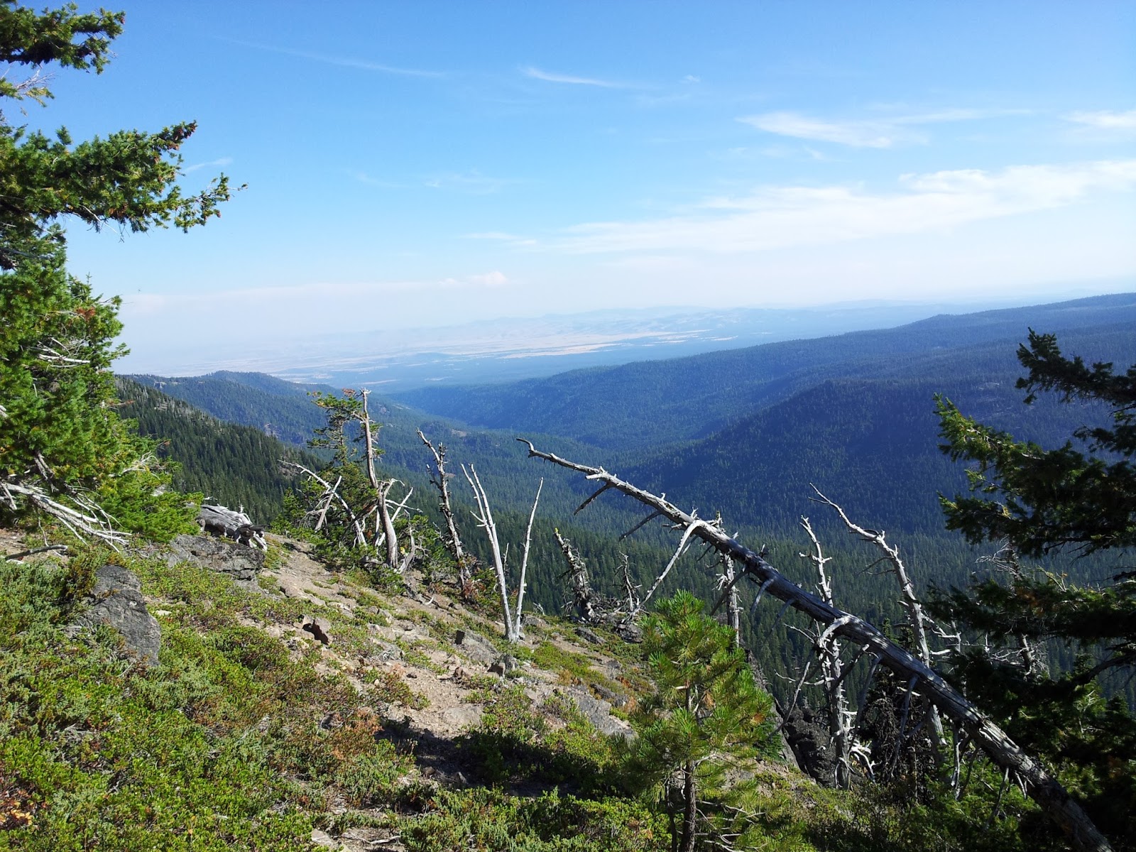
The Valley below where I will be continuing my hike. (Badger Creek Wilderness)
On the way to the summit of Lookout Mt, it almost looks like God made steps to the top.
Some 40 years ago or more, there was a forest look out building at this site. There are remains of the foundation.
The summit of Lookout Mt.
Mt Hood from the Summit
I began my trek down to Badger Lake. Amazing views all the way down.
An area that was a forest fire. Looks fairly recent. Within a couple years.
Lots of meadows on the trail down. I can only imagine, they have deer and elk in them in the evening and early morning. Lots of tracks along the trail.
This area will be incredible in July/August with the flowering meadows. There are still a few flowers still in bloom.
Heading closer to the lake, the trail becomes more dense with trees.
One of my stops to refill water bottles. Spring water is soooo good.
Badger Lake
Badger Creek leading out of the lake. There is a dam on this end and not sure what this lake is used for. It is in the middle of the wilderness. I believe it might be for fire suppression.
The trail back to the top of Lookout Mountain.
Back at the top of Lookout Mountain. You can see the lake in the upper right of the pic. That is where I hiked to.
Each side of Lookout Mountain had unique rock formations and even red cinder volcanic rocks.
Final stats.