
July
Full July Album Pics Click Here
Click on images throughout blog for a larger image.
In past years I would be very active outdoors, throughout the seasons. Now that I am limited with physical activity, I have had to make some life changes. Mountain biking and hiking were two activities I can no longer do. I have been working with a pain psychiatrist and he told me that if I can no longer do one thing, find another to replace it. When he told me this, I already had my new scooter on order. I had explained to him that I recently sold my mountain bike, and as I was driving away from the sale location, I cried. It hit me very hard that these changes are happening. I mentioned that I had ordered a scooter to get me out into the back country to explore areas that I used to mountain bike in. My pain psychiatrist was thrilled that I had already began the replacing of my activities. He gave me homework to work on. Find a replacement for what I normally would do during the winter. Ann Marie's volleyball club and high school careers are over. So no more of that. No skiing. So I am working on a plan for this winter. Stay tuned.
My scooter (Scooterstar Roguestar 50) arrived in early July. It is a 50cc size. Meaning I do not need a motorcycle endorsement to ride it on streets. It is not very fast, which is ok for me. It's top speeds are 30+mph on a flat surface. Going up hills is much slower. My goal was to replace the mountain bike, which was much slower. It is a 4 stroke engine and gets around 100 miles per gallon. I had looked at eBikes, but the range and electricity requirements were very limiting.
The scooter has been a game changer for me. In mid July I went camping in the Metolius River area. I brought my scooter. No I didn't ride it there. I have a motorcycle rack attached to my van. I set up camp in a dispersed camping site and made that my home base for the week. Even though riding the scooter is much easier than a mountain bike, I still have to pace myself. I have to plan on routes that are not too long or exhausting. And I plan on frequent rests. Some days, I am feeling like crud and just stay at camp. I am learning my limits and try not to exceed them.
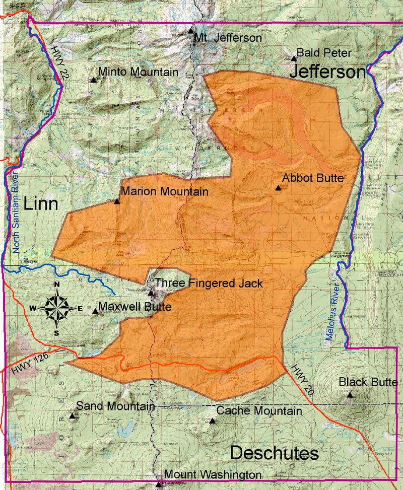
My July scooter adventure began with a short ride through the western portions of the Metolius Basin. I went to a cinder cone that has amazing views. Sisters Mountains, Mt Washington, Three Finger Jack and Mt Jefferson are all within view. It is a popular location for folks to shoot. So camping here is not recommended.


I continued my journey that day through the lower lands of the Metolius Basin. I came upon horse camps and many streams. Canyon Creek and Jack creek are a couple nearby. The waters are clear and cold. I carry a water filter with me, so stopping off and getting a drink is welcome in the hot Central Oregon Sun.

The next day I had planned on a much longer ride. I was feeling pretty good. I mapped out my route and set my goal of reaching the Green Ridge fire lookout. Of all the years I have been to this area, I had never been to the lookout. The route took me on the east side of Green Ridge. Green Ridge parallels the Metolius River to the east for 10 miles. I took forest roads that near the end were pretty rough. As I rested and enjoyed the views from the lookout, I looked at my map and realized there is a forest road that goes down from Green Ridge to the Metolius River on the west side. So I took that road on the way back. It was much quicker. But very rough road.

The next couple of days, I relaxed by the Metolius River. I used my scooter to get me to a couple of spots that I like to hang out and enjoy the river. I then headed home.


August
Full August Album Pics Click Here
Click on images throughout blog for a larger image.
I returned to the Metolius Basin in early August. There is so much area to explore. Much of the area I explored was in an area that the B&B Complex Fire burned in 2003. Around 100,000 acres burned. I had hunted, hiked and mountain biked this area before the fire. I have not returned to much of the area until this trip. The landscape is very different than when I remembered it from before. Views that were never seen, are now seen. The fire was naturally caused by lightning. You can read all the history of the fire here - https://learnforests.org/sites/default/files/AnatomyofaWildfire.pdf

As I rode through areas of the burn, the size of the burn area kept growing. I have seen the burn area from the highway, but not while standing in the middle of it. It is massive. There are thousands of acres of trees that burned and died. There is a natural recovery of the trees. Every where I rode, I could see new pines growing where the old trees were gone. I believe they are Lodgepole Pines and Ponderosa Pines.
The route took me to Abbot Butte. There once was a primitive road to the top. But since the fire, it has been removed. I did go to the base of it and there were many burned trees standing bare. It was very spooky. The wind was howling and I heard what I thought were coyotes yelping. But as I listened, I realized they were the trees singing in the wind. There are no needles on the trees. Just bare limbs. As the wind picked up, the trees would whistle and howl as if they were speaking to me. My plan was to ride a bit longer, but as I looked to the south, I could see thunder storms forming and moving my way. I headed back to camp and was hit with a storm. It only lasted about 20 minutes.

The next day, I explored the NW area of the Metolius Basin. The Southern Border of the Warm Springs Indian Reservation is in that area. The B&B Fire stretched into the reservation and beyond. So much of the area I rode was affected by the fire. I did not go onto the reservation as there are signs that say no trespassing. As I rode along the Deschutes National Forest, I came upon no trespassing signs. This was not the reservation. I was puzzled to see these signs in the middle of the forest. As I rode along about a 1 mile stretch, I came upon a series of buildings. A home was there. As I looked closer, I saw several boats on trailers on the property. The boats, Jet Boats, were painted in Red White and Blue and read War Fighters on the side. After returning to camp, I researched online what I had seen. I found https://warfighteroutfitters.org/ A non profit that takes injured war veterans on outdoor adventures. Just prior to the home and boats, I saw a couple of crosses on the private land. I got a closer look and the one on the left reads 'Chris' and the one on the right reads 'K'. The crosses are about 20 ft off the cinder road.

I approached the Indian Reservation and went to a nearby stream to take a nap and rest. There are two streams just prior to the reservation.


I took a day off, but the following day, I set my goal on going to Jack Lake. It is a lake where a trailhead begins for Three Finger Jack trail. Along the way, I rode through the burn area and witnessed some amazing views. The road was long and rough. But I made it. While at the lake, it was very windy. So I only stayed for a few moments.


On the way back I took several forest road spurs. I found some streams and awesome views along the way back to camp.

